
Features SMASH - Digital Field Mapping
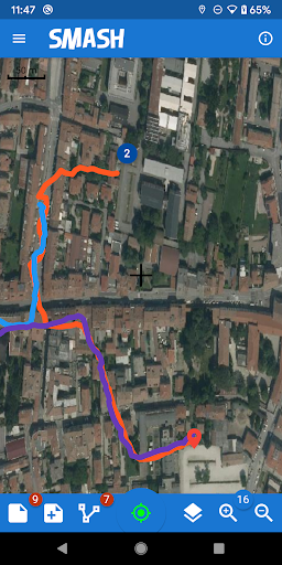
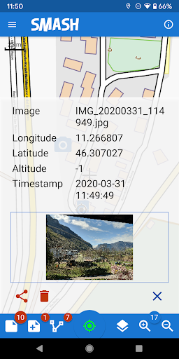
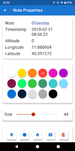
SMASH is a digital field mapping application developed to perform fast qualitative engineering/geologic surveys and GIS data collection.The main aim of SMASH is to have a tool that:* fits in any pocket and can be always at hand, when needed* gives the possibility to take geo-referenced and possibly orientated pictures during a survey, with further possibility to import them into GIS applications like gvSIG* is able to easily exploit an Internet connection, if available* is extremely easy to use and intuitive, providing just few important functionsThe main features available in SMASH are:* geo-referenced notes* geo-referenced and oriented pictures* gps track logging* form-based data surveys* easy export of collected data* a map view for navigation with support for raster tiles and gpx vector data* geopackage (OGC standard) support
Social Features
Connect and share with friends and the community.
Fitness Tracking
Track your workouts and monitor your health metrics.
Travel Features
Plan and manage your travels with ease.
See the SMASH - Digital Field Mapping in Action
Get the App Today
Available for Android 8.0 and above